![NOCI logo.png]](https://knowledge-software.noc-innovations.com/hs-fs/hubfs/NOCI%20logo.png?height=50&name=NOCI%20logo.png)
The reference datum used for the models in POLPRED is the 'undisturbed sea surface parallel to the geoid'. This can be approximated to Mean Sea Level (MSL).
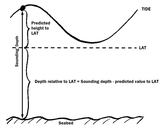
Within the POLPRED software, computed data can be changed to Lowest Astronomical Tide (LAT) datum. The value used for LAT is an estimate based on a calculation of the tide over a 19 year cycle using the model data set.
Taking the elevation values relative to MSL we apply a datum shift by subtracting the LAT value, this gives us the elevations relative to Lowest Astronomical Tide (LAT). The current speed and direction will be the same whether the datum is LAT or MSL.