How does the weather impact tidal predictions?
Meteorological Effects on Tidal Predictions
The data given in a tide table is computed for average meteorological conditions. However
when the conditions are not average the levels may differ from those predicted. Under extreme
conditions these differences can be very large.
Barometric Pressure
Tidal predictions are computed for average barometric pressure. The average barometric pressure for the United Kingdom varies between 1016mb along the south coast of the U.K. to 1011mb in the north of Scotland. A difference from the average of 1mb can cause a difference in height of about 1cm. Low pressure will tend to raise sea level and high pressure will tend to depress it. The water level does not, however, adjust itself immediately to a change of pressure, it responds to the average change in pressure over a considerable area.
Changes in level due to barometric pressure seldom exceed 0.3 metres but, when mean sea level is raised or lowered by strong winds or by storm surges, this effect can be important.
Wind effects
The effect of wind on sea level - and therefore on tidal heights and times - is very variable and depends largely on the topography of the area in question. In general it can be said that wind will raise sea level in the direction towards which it is blowing. A strong wind blowing straight onshore will pile up the water and cause high waters to be higher than predicted, while winds
blowing off the land will have the reverse effect. Winds blowing along a coast tend to set up long waves which travel along the coast, raising sea level where the crest of the wave appears and lowering sea level in the trough. These waves are known as "storm surges". They have a period of many hours and wavelengths measured in hundreds of kilometres.
Storm surges
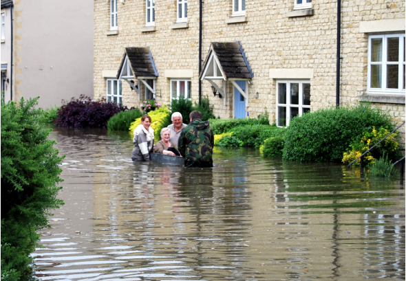
Storm surges are a rise above (positive surge) or fall below (negative surge) the normal predicted tidal level on the open coast caused by both static pressure and dynamic wind effects. A typical oscillation of sea level can be set up when a strong southerly wind is abruptly replaced by a strong northerly wind.
For example when water which has been piled up in the north part of the North Sea is released and travels south as a wave or series of waves, it can be given added impetus and amplitude by the northerly wind. It should be noted that oscillations of sea level are not restricted to movement from north to south and vice versa; similar oscillations may take place from east to west and in
other directions or could result from a combination of several different oscillations resulting in a
complicated pattern of changes in sea level.
The highest surges tend to occur when a deep depression, moving in from the Atlantic, travels slowly across the north of Scotland from west to east, causing strong and sustained north-westerly or northerly winds. A wave is set up which travels down the coast at approximately the same speed as the tidal wave i.e. if the wave's crest arrives at, say, Aberdeen near the time of high water, the same crest will arrive at the Tyne near high water and will also arrive further south at or near the time of local high water.
Of equal importance to the time at which the crest of the surge arrives is the range of the tide on the day in question. Surges which occur at or near neap tides (i.e. tides of decreased range which generally occur just after the times of first and last quarter) seldom cause abnormally high levels, but relatively small surges occurring at or near spring tides (i.e. tides of increased range occurring just after full or new moon), especially equinoctial springs, can be dangerous.
Large positive surges of this kind are fortunately rare but smaller surges which raise the height of high or low water between O.6m and 0.9m are not infrequent and may occur several times during a normal year in the North Sea. Negative surges of over 0.6 metres occur about 15 times a year in the southern North Sea, sometimes exceeding 1 metre.

Protecting the UK from flooding
Following the abnormal tides of January 1928 (when 14 people were drowned in London), a rudimentary flood warning service for the capital was established by the Met Office. Following the severe storm of January 1953 (when 300 people were drowned) a full storm tide warning service was established under the general administration of the Ministry of Agriculture, Fisheries and Food (MAFF).
This service, known as the Storm Tide Warning Service (STWS) was operated from the Meteorological Office in Bracknell, Berkshire. The STWS constantly monitored the residual tide (i.e. the difference between the actual level and the astronomically predicted tidal level) from Stornoway to Newhaven including Wick, Aberdeen, North Shields, Immingham, Lowestoft, Felixstowe, Southend, Sheerness, Dover and Newhaven; and on the west coast at Newlyn, Ilfracombe, Fishguard, Holyhead, Heysham and Millport. Surge predictions are based on empirical equations and mathematical numerical models of the UK continental shelf seas, the
latter developed at the Proudman Oceanographic Laboratory (now the National Oceanographic
Centre).
The Met Office moved from Bracknell to Exeter in 2003 and is now the home to the UK Flood Forecasting Centre (opened in 2009) – a joint partnership between the Met Office and the Environment Agency to provide improved flood risk guidance for England and Wales.
http://www.ffc-environment-agency.metoffice.gov.uk/

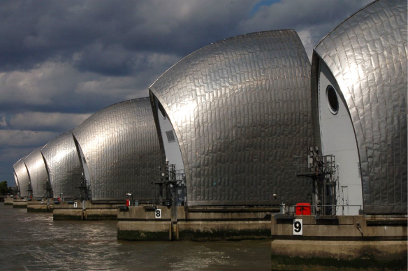
The Thames Barrier is operated by the UK Environment Agency and protects London from
major storm surge evenets. The National Oceanography Centre work closely with the
Environment Agency to help define the threshold levels at which the barrier should be closed
![NOCI logo.png]](https://knowledge-software.noc-innovations.com/hs-fs/hubfs/NOCI%20logo.png?height=50&name=NOCI%20logo.png)