![NOCI logo.png]](https://knowledge-software.noc-innovations.com/hs-fs/hubfs/NOCI%20logo.png?height=50&name=NOCI%20logo.png)
To view tidal currents and water elevations first make sure that you have the required model for the area you wish to view and then zoom into that area. Select 'Spatial' from the left hand side menu and the dialogue box below will appear:
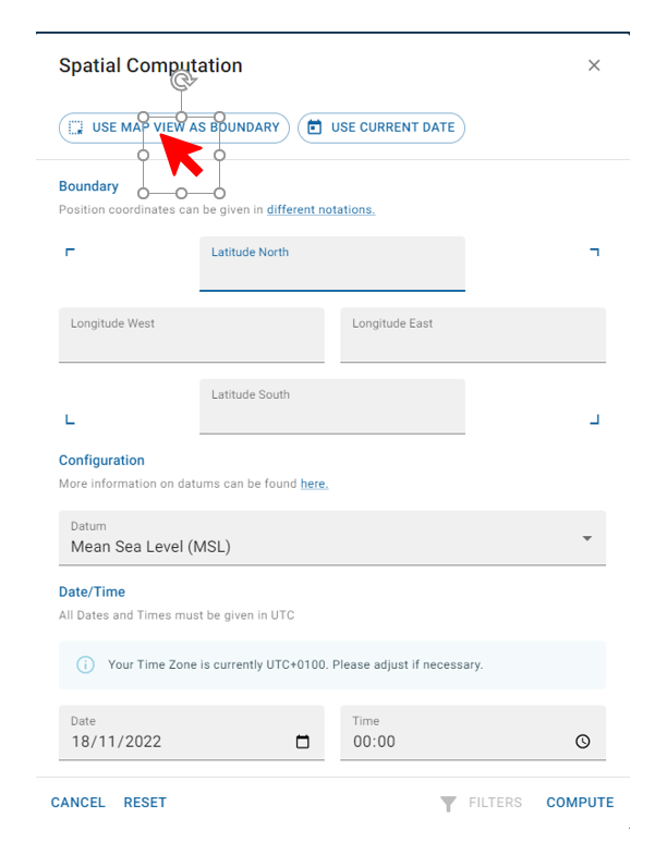
Here you can either enter the coordinates manually for a rectangle defining the area you wish to view or select the icon shown with the red arrow to set the boundaries of the area to those you can view on the screen. (Note that setting a very large area here will create a delay in terms of processing a larger amount of data in the model so it is better to select as closely as possible the area you require).
Having selected the area click on 'COMPUTE' on the bottom right hand side of the window.
This will bring up a page of data showing the tidal height, current speed and direction for each point within the area. You can choose to select different columns and export the data to another software package for analysis or view the data graphically on the map - see video.