![NOCI logo.png]](https://knowledge-software.noc-innovations.com/hs-fs/hubfs/NOCI%20logo.png?height=50&name=NOCI%20logo.png)
Details
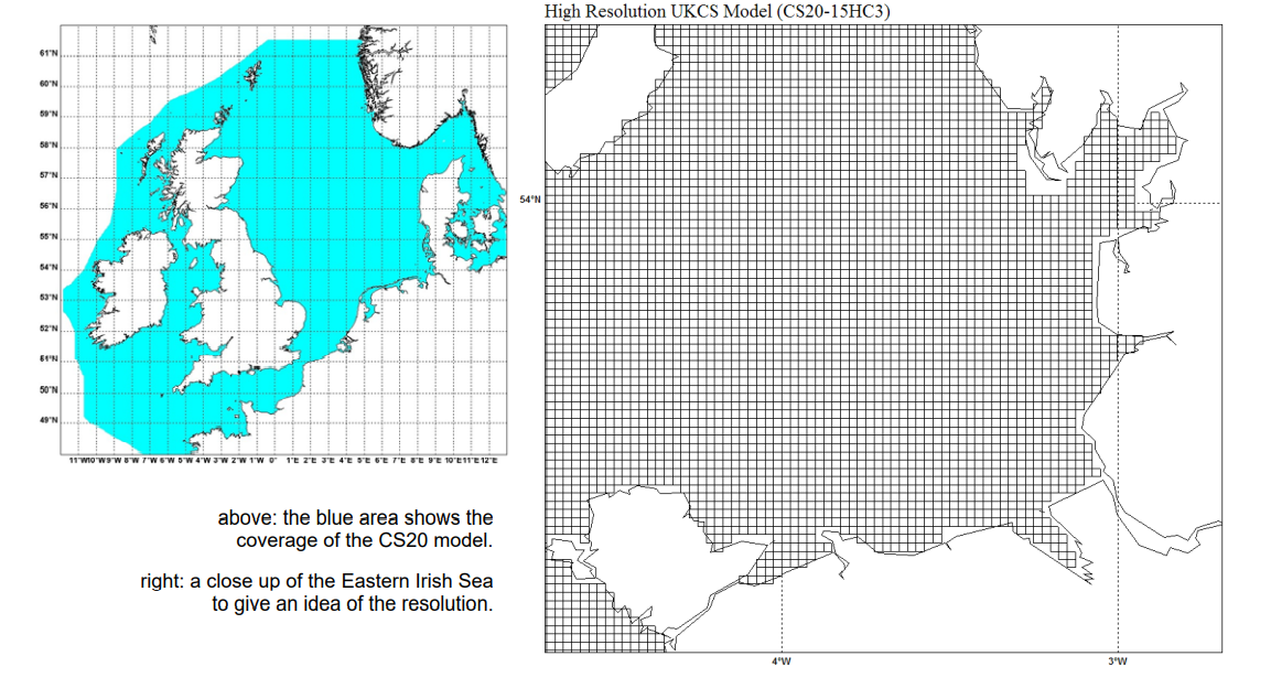
1/60° latitude by 1/40° longitude - horizontal resolution approximately 1 nautical mile ( 1.8km).
Area: 12°W-13°E; 48°N-61°30’N within the 200m depth contour at the continental shelf edge.
Currents are computed at 32 different depth levels through the water column and not deduced from the depth-averaged currents and scaling factors as in the CS3-3D model.
See also: CS20 Sigmas Info Sheet
Model Grid