![NOCI logo.png]](https://knowledge-software.noc-innovations.com/hs-fs/hubfs/NOCI%20logo.png?height=50&name=NOCI%20logo.png)
The NOC High Resolution 3D Continental Shelf Model (CS20) has data computed at 32 different depth levels through the water column.
Background Information
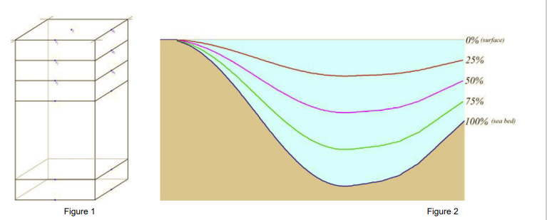
Figure 1 shows a simplified 3D model divided up into a number of vertical slices. These slices can be defined at fixed levels (for example every 2 metres), however, a more useful method is to define the level at specific fractions of the depth for that grid cell called sigma-coordinates as
used in the CS20 model. In a sigma coordinate system, the number of vertical levels in the water column is the same everywhere in the domain irrespective of the depth of the water
column. The sigma coordinate model also enables the bottom (benthic) boundary layer to be better resolved across the whole domain. Each model cell contains one value for every variable of interest.
Sigma Levels in POLPRED
POLPRED is fundamentally a 2D modelling package. Although you can work with multiple layers from a 3D model, only one can be loaded into the software at the same time. Therefore when you purchase the POLPRED software you must specify which layers are required. The CS20 model is divided into 32 sigma levels. The most common layers supplied with POLPRED are surface, mid-depth or near bed currents, although any of the 32 evenly spaced layers are available.