![NOCI logo.png]](https://knowledge-software.noc-innovations.com/hs-fs/hubfs/NOCI%20logo.png?height=50&name=NOCI%20logo.png)
IF YOU KNOW YOUR LOCATION COORDINATES AND WISH TO ENTER THEM DIRECTLY:
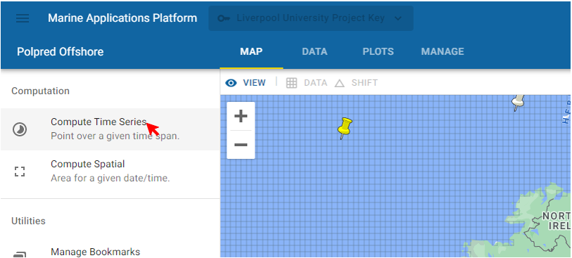
Select 'Compute Time Series' from the left menu:-
The following window will appear:-
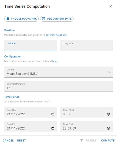
Enter the exactly coordinates of the location you want along with the start date and time of when you want predictions to start and the frequency (interval) of how often you want new predictions.
IF YOU WISH TO SELECT A POINT ON THE MAP
Zoom into the area where you have a location and select the point you want. The coordinates of that point will appear as below:
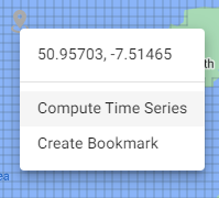
Click on 'Compute Time Series' at that point to open a window (as shown above) with those coordinates already populated. You can adjust them manually as required:
AFTER SELECTING OR MANUALLY ENTERING YOUR COORDINATES (Either Method Above)
Select 'Compute' to view the data for your location. You can also choose to bookmark the location or return to the current date for the calculations using the buttons at the top of the screen.